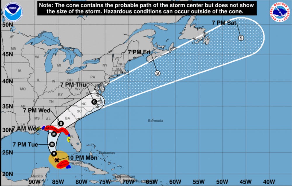
Hurricane Michael may be a Category 3 storm when it makes landfall in Florida late Wednesday or early Thursday, meteorologists predict.
Alachua County was declared a State of Emergency by Rick Scott in a tweet Monday morning.
Senior UF administrators will later to discuss Wednesday’s schedule, according to an email sent to students Monday night. An official update will be posted on the UF home page or on www.ufl.edu/alerts/michael.html by 11 a.m. Tuesday.
Hurricane Michael’s winds will strengthen up to 120 miles per hour as it moves north over the Gulf of Mexico, said Tony Hurt, a Tampa Bay National Weather Service meteorologist. Winds between 111 mph and 129 mph are considered Category 3, according to the National Hurricane Center. The storm is projected to hit west Florida coastal areas by 2 a.m. Thursday.
Hurricane Michael is currently 485 miles south of Panama City, Florida.
Hurt said the maximum amount of flooding currently expected will be in the Cedar Key area with six to nine feet later in the week.
Hurt said Michael’s track has not changed, but the intensity of the hurricane has increased. Hurt said Category 3 hurricanes and higher are called “major hurricanes.”
Hurricane watches are in effect from the Suwannee River to the Florida-Alabama border. Tropical storm watches are in effect extending from the Suwannee River down to Anna Maria Island, Hurt said.
Steve Orlando, a UF spokesperson, said the university has not decided to cancel classes this week.
Hurricane Michael's path as of 10 p.m. on Monday.


